


Seven floors underground, in the depths of the Civil Engineering Building, researchers have an interesting way of studying something at ground level that could be very boring.
It seems like an unlikely place for traffic monitoring, but this lab houses a variety of top-notch technology.
Here, Minnesota Traffic Observatory staff use virtual reality and interactive mapping to look at transportation design and traffic safety. Highway cameras supply the observatory with real-time footage of more than 300 metro-area locations.
John Hourdos, director of the MTO, said traffic safety is the primary purpose of the observatory, but acknowledged it’s a unique place to work.
“It’s a different appreciation when you know you’re in a mine,” he said, referring to how the space was used in the past.
Hourdos and other staff members have used the technology developed there to improve major area roadways.
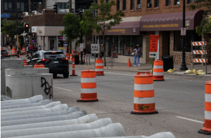
With the help of footage from highway cameras, Hourdos and others identified one of the most crash-prone areas of freeway in the Twin Cities – a stretch of westbound Interstate 94 near the Portland Avenue overpass.
By monitoring car accidents, they identified one reason the area was so dangerous: merging patterns. As a result, officials changed ramp markings, which has resulted in fewer crashes, Hourdos said.
More discoveries like this one could happen in the future thanks to the observatory’s virtual-reality system, CAVE.
Ted Morris, the lab manager, used data from the highway cameras to create a model of what highway s look like, and what they could look like if changes were made.
CAVE may even eventually incorporate driver behavior under certain traffic conditions. Morris said it’s better and cheaper than methods used in the past.
“In the end, you come out with a situation that would really work,” Morris said.
The observatory also has a geographic-planning table, which allows researchers and planners to collaborate during the design process.
The table displays maps of roadways, allowing users to identify and discuss problems. Users can also digitally write notes and suggestions on the table. The computer captures and saves the notes.
Transportation planners from the Minnesota Department of Transportation, Metro Transit and the University have worked with the observatory in the past. Occasionally, partners have ventured below ground to use its technological resources.
Although a lot of research happens in the lab, the MTO is also used for education.
Chen-Fu Liao, the educational systems manager, said classes aren’t taught in the lab, but undergraduate civil engineering classes visit from time to time.
Mostly, graduate students spend time in this underground research haven.
A lounge next door to the observatory provides simulated sunlight and several plant arrangements for students and staff who spend most of their days far below the rest of street-level campus.