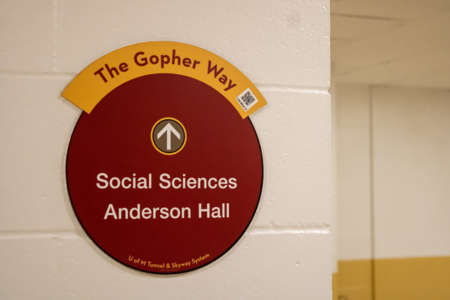
The Undergraduate Student Government (USG) and Parking and Transportation Services (PTS) announced the addition of QR codes on select Gopher Way signs Feb. 22.
The change comes as a result of USG’s Infrastructure Committee seeking to improve navigation in the Gopher Way tunnel system at the beginning of the school year, according to Daniel Tobias, president of USG’s Infrastructure Committee.
“We heard from a lot of students that had some general concerns about navigation,” Tobias said. “Some signs felt confusing because of their placement or they didn’t tell you to go up or down a level, and sometimes there was a lack of signage in some areas.”
When students scan the QR codes added to some signs in the Gopher Way using their mobile devices, they will be redirected to a map showing a student’s current location with letters as markings.
“The idea is that [the codes] are dispersed all around campus using a target point,” Tobias said. “We do have a few [target points] on West Bank and a few on East Bank.”
Navigating tunnels can be difficult, students say
The Infrastructure Committee partnered with PTS, which oversees all aspects of campus transportation, including providing digital maps to the University community. PTS meets with USG monthly to discuss transportation issues, service changes and projects.
“When the students identified portions of the Gopher Way that are difficult to navigate, we felt it was important to see what improvements could be made,” PTS Director Ross Allanson said in an email to the Minnesota Daily.
PTS originally piloted the QR code system in 2020 to replace a printed walking guide to make navigation easier for students and staff.
Tobias said he has personally felt navigation through the tunnels is difficult at times, especially in the Gopher Way’s longer pathways.
“The signs tell you pretty well how to get from building to building, but if you want to go further than an adjacent building, it’s a little more difficult to travel those longer distances,” Tobias said.
Yebin Lee, a second-year student and member of the infrastructure committee, said when she first came to the University, she felt there were no resources for navigating the Gopher Way tunnels.
“I know for a fact that a lot of my friends would love to stay inside because it’s so cold out, but they just didn’t know how to do that,” Lee said.
Lee said she noticed many people were not utilizing the tunnels despite the recent cold conditions, which she attributed to a lack of navigation services, saying the tunnels are a unique way of getting around campus she wanted other students to use.
“It really is helpful because we can’t always post physical maps everywhere, and they run out quickly,” Lee said.
QR codes could lead to interactive map development
The student demand for an interactive map of the Gopher Way tunnel system was high, according to Tobias. An interactive map would allow students to get directions to and from certain locations, and Tobias said the QR codes are a first step toward making interactive maps available.
“It would make it extremely easy, but going through the process, you definitely see how something as simple as this takes a lot of planning and technology,” Tobias said.
The Infrastructure Committee hopes to assess the effectiveness of the QR codes by April and determine whether more QR codes are needed or if they are unnecessary after all. The committee plans on sending out a survey to students and using data from the survey as part of their analysis.
“Most of it is going to be seeing what locations are most utilized in terms of how often students scan the QR codes just to see where there is demand for that and if students are using them at all,” Tobias said. “We can hopefully move forward with something that will improve navigation, and I don’t know what that looks like, but this is definitely a good first step.”


